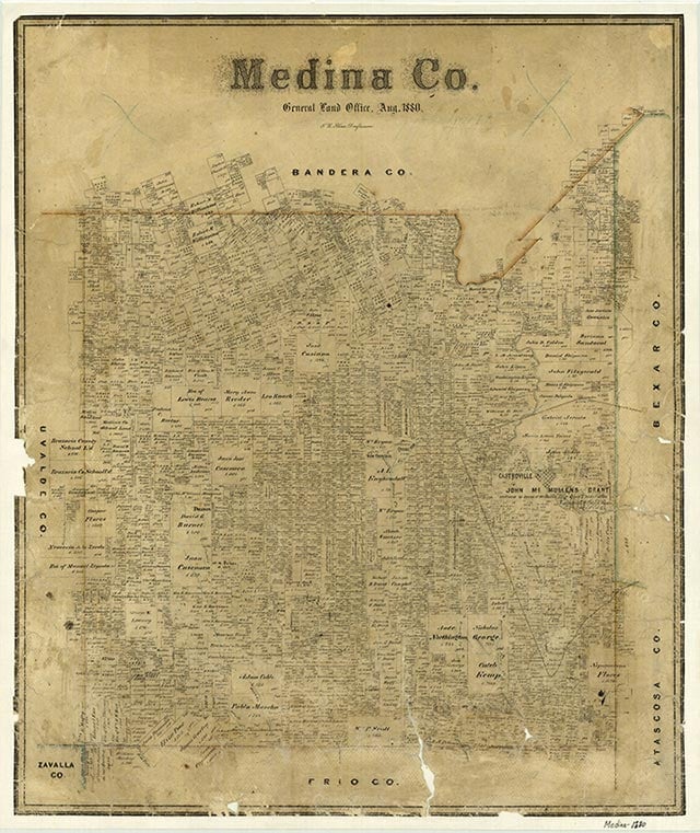
Medina County is immediately west of Bexar County in southwest Texas. Hondo, the county seat, is located near the geographic center of the county at 29°17' north latitude and 99°02' west longitude, 100 miles from the Mexican border at Eagle Pass. The Medina River, from which the county derives its name, traverses the northeastern portion of the county. The western part is drained by the Frio River. Medina County covers 1,331 square miles with elevations ranging from 1,995 feet in the northern Hill Country to as low as 635 feet in the southern region. The county is divided from east to west by the Balcones Escarpment, which separates the Edwards Plateau and Hill Country to the north from the Rio Grande Plains to the south. The climate is subtropical and subhumid; the summers are hot and dry. Annual rainfall averages 28.43 inches; average relative humidity is 81 percent at 6 A.M. and 49 percent at 6 P.M. The temperature averages a low of 42° F in the winter and a high of 96° in the summer. The annual growing season is 263 days. The northern Hill Country region has black waxy and limestone soils that support grasses, brush, junipers, mesquite, shinnery oaks, and live oaks. The larger southern region has sandy loam and clay soils that support bluestem, buffalo, and Arizona cottontop grasses, as well as post oak, live oak, and mesquite. Cypress and pecan trees are commonly found on the banks of rivers and creeks. Approximately 45 percent of the land in the county is considered prime farmland. Medina Lake Reservoir, completed in 1913 in the northeastern part of the county, furnishes impounded Medina River water for an extensive irrigation system throughout the eastern half of the county. Other man-made surface reservoirs have been built on Chacon, Parkers, Squirrel, Live Oak, and Elm creeks. Ranchers keep local stock tanks for water. Most subsurface or ground waters in Medina County are artesian; two major subsurface water belts are the Edwards Aquifer and the Carrizo Sand Aquifer. The county can be divided from north to south into three geological sections, the Lower Cretaceous of the Edwards Plateau, Lampasas Cut Plain, and the Comanche Plateau; the Upper Cretaceous of the Blackland Belt; and the older Tertiary of the Gulf Coast Plain. Mineral resources within the county include oil, gas, clay, sand, and gravel. High-quality clays for the production of bricks and tile are found in the D'Hanis area of western Medina County. Limestone, readily available and of good quality, is used extensively for buildings and hand-carved tombstones. Crushed limestone, flintstone, igneous pebbles, caliche, and clay are found in the county and are used widely as road materials. Bat guano is commercially mined in the limestone hills north of Hondo and marketed as a high-quality natural fertilizer. The guano mined at Ney's Cave, claimed to be one of the largest bat habitats in the world, was used in the manufacture of gun powder during the Civil War.
Medina County is in an area that has been the site of human habitation for many thousands of years. Evidence of early man has been discovered at a site known as Scorpion Cave on the Medina River in the northeastern part of the county. Archeologists believe that ancestors of either Coahuiltecan or Tonkawa Indians occupied this cave continuously for several thousand years before the arrival of the first Europeans. The first Spaniard to set foot in the region was probably Alonso De León, governor of Coahuila, who passed through the area in 1689 en route to East Texas, and named the Medina River and Hondo and Seco creeks. Two years later Domingo Terán de los Ríos, the first provincial governor of Texas, tracked across southern Medina County, laying the foundation for El Camino Real (Old San Antonio Road). The Upper Presidio Road, as the Camino Real was known in 1807, purposely skirted the Indian strongholds of the Hill Country beyond the Balcones Escarpment. Throughout the 1700s the area was frequented by roving bands of Lipan Apaches and Comanches, whose seasonal raiding parties traveled south from the plains area of North and West Texas and New Mexico on their way to Mexico. From this vantage point the Apache-Comanche Indians would attack San Antonio with impunity. The Republic of Texas was convinced that if this large block of land were settled it would provide a protective zone against any invasion forces approaching San Antonio from the south and west. They negotiated an empresarial contract with Frenchman Henri Castro on February 15, 1842, to settle the area. One of Castro's land grants began four miles west of the Medina River. He purchased the sixteen leagues between his granted concessions and the river from John McMullen of San Antonio. The Old San Antonio Road to Laredo and the main road from San Antonio to Eagle Pass both crossed the land grant.
Castro, with the assistance of German wine merchant Ludwig Huth and his son Louis August Ferdinand Huth, arranged the transport of German and French-speaking farmers from the Alsace region of northeastern France, brought them overland from the Texas coast to San Antonio, and on September 2, 1844, set out with them in the accompaniment of Texas Ranger John Coffee (Jack) Hays and five of his rangers to decide upon a site for settlement. Castroville, founded on September 3, 1844, was the westernmost settlement in Texas. It received the first post office in the county on January 12, 1847. In a relatively short time the settlements of Quihi (1845), Vandenburg (1846), New Fountain (1846), and Old D'Hanis (1848) were established. The layout of each of these settlements was similar to that of Castroville, in a pattern reminiscent of their European villages. The settlements were laid out in town lots surrounded by outlying twenty and forty acre farming plots. Settlers lived in the protective environs of their towns and farmed their nearby fields. The immigrants brought with them their unique culture and a distinctive architecture. By the mid-1850s buildings were being made of rough-cut native limestone, sandstone, or some combination of stone and timber; lime plaster was used to coat the exterior walls and adobe the interior walls. The colors found in the stone ranged from an offwhite, common in the Castroville area, to a rich blend of ochres and gold characteristic of the New Fountain and Quihi communities. Houses were designed with a characteristic rectangular shape, short in the front and long at the rear roofline, common to the rural structures of their homelands. Most homes and buildings had fireplaces built with internal angular flue systems.
Medina County was separated from Bexar County by the legislature on February 12, 1848, and enlarged on February 1, 1850, again gaining lands from Bexar County. At this time the population of Medina County was estimated to be predominantly Catholic at a ratio of five out of every six people. The first church in the county, the Catholic Church of St. Louis Parish in Castroville, was completed in November 1846. The Lutherans organized churches at Castroville and Quihi in 1852 and 1854. The Catholic church organized a school in Castroville in 1845; the Protestants did likewise in 1854. The first public school in Medina County was also established in Castroville in 1854. By 1858 the county had five schools for 453 pupils and five churches, three Protestant and two Catholic. A short-lived Mormon community was established in northeastern Medina County in 1854. By 1858 stock raising and the cultivation of corn were the chief agricultural pursuits in the county. Much of the labor needed to clear the land for homes and farms was done by Mexican laborers. Statistics taken in that year show 10,000 acres of corn planted and 100 acres of wheat on 240 farms; there were 11,000 cattle, principally in the Castroville, D'Hanis, Quihi, and Vandenburg areas; sheep were raised principally in the northern hilly and rocky areas. Peach trees were abundant; cypress and pecan grew along streams and rivers; mesquite, live oak, post oak, and cedar were prevalent trees in the prairies. Castroville, with a population of 366, was the twelfth-largest town in Texas and an important commercial center by 1850. Fort Lincoln had been erected in 1849 near Old D'Hanis to furnish protection for the new settlements and commercial traffic between San Antonio and Mexico. Most settlers operated subsistence farms while they learned stock raising, which many realized was best suited to the area. The typical diet consisted of corn-meal mush, garden vegetables, and wild game. In 1850 there were only twenty-eight slaves in the estimated 909 citizens of Medina County. In 1858 the estimated population of 1,300 included 104 slaves. In 1860 there were 108 slaves. Two conditions in Medina County served as a deterrent to slavery; its proximity to Mexico offered sanctuary for runaway slaves, and the Unionist sentiment disfavoring the institution of slavery was general among the European settlers. In February 1861 the vote was 140 for and 207 against secession. August Santleben, a Union sympathizer, was one of many Medina County citizens who fled to Mexico to avoid recriminations at the hands of Confederate allies like Charles DeMontel, who as provost marshal was responsible for apprehending those who attempted to escape Confederate service. The value of Medina County land during the Civil War dropped by almost 50 percent. Education and schools suffered during the war as funding plummeted. However, communities like Castroville, situated on the commercial routes to Mexico, prospered. After the war a number of German immigrants arrived. By 1870 a majority of the 2,078 people in the county were of German or French origin; there were ninety-two Blacks, forty Mississippians, and thirty-three Mexicans.
The arrival of barbed wire and the railroads during the 1880s was a significant turning point for Medina County. Cattle raising had more than doubled during the 1870s. Property values tripled during the same period. Barbed wire effectively ended the practice of free-range cattle ranching; disputes over grazing access led to many conflicts. Livestock raising was the dominant agricultural activity in 1882; large sections of land supported 33,000 cattle, 33,000 sheep, 8,000 horses and mules, and 4,000 hogs. The Galveston, Harrisburg and San Antonio Railway and the International and Great Northern Railroad extended their lines west and south through Medina County in 1881 and 1882, respectively. The towns of Hondo, La Coste, Dunlay, and New D'Hanis were established along the GH&SA; the towns of Devine and Natalia were established along the IG&N. The citizens of Castroville, after having been given the initial opportunity to have the GH&SA pass through their township, voted against the issuance of bonds necessary to support such a route. The rapid commercial and population growth of the newly established railroad towns, particularly at Hondo and Devine, significantly altered the future demographic makeup of the county. The number of county schools between the years 1882 and 1894 increased from four to thirty-six. The population increased from 4,545 in 1880 to almost 8,000 by 1900. After several unsuccessful attempts to move the county seat from Castroville to Hondo during the 1880s, the change was finally approved in 1892 by a vote of 767 to 687. By then Hondo and the other railroad communities had become the most convenient and economically accessible marketing centers. Changes in demographic influence were evident in the embryonic newspaper publishing industry as well. The county's first newspaper, the Castroville Era, began operations in 1876. This newspaper was changed to the Quill in 1879 and was sold to a group in Hondo in 1884, when it was renamed the Medina County News. Without a newspaper of its own and apprehensive of Hondo's attempts to gain the county seat, Castroville began publishing the Anvil in 1886. By 1903 the Anvil had been consolidated with Hondo's Herald to become the Hondo Anvil Herald. The developing railroad community of Devine was publishing the Devine Wide-Awake in 1892 and the Devine News in 1898. By 1900 more acreage was devoted to the production of cotton than corn (22,293 acres for cotton to 16,385 for corn). However, by 1905 the boll weevil had come in from Mexico and eventually devastated the cotton industry. In 1920, 44,061 acres were devoted to corn, and 32,196 acres were used for cotton production. By 1940 only 5,986 acres were devoted to the production of cotton.
The completion of the Medina Dam in 1913, at that time the fourth-largest dam project in the United States, provided water sufficient to irrigate an estimated 60,000 acres. Six million dollars had been raised through the sale of bonds to British subscribers to finance the project. The onset of World War I cut off the flow of British capital, significantly reducing the sale of farmland dependent upon the irrigation system. The irrigation project was placed in receivership by the federal courts in 1914 and remained in this suspended condition until 1924, when it was ordered to be sold at public auction in Hondo. Dust bowl victims from Oklahoma and Kansas made up a large portion of the prospective buyers of farmland. Many of the landowners in the irrigation project were beset with heavy mortgages, but they were ultimately rescued by successful application to the Reconstruction Finance Corporation of the United States in 1934 that resulted in a reduction of the farmers' bonded indebtedness from $2.5 million to $250,000. Row crop tractors replaced the early hay burners and horses and mules that had been used into the 1930s. Pull-type combines replaced the labor-intensive threshers and reapers. Until the advent of the state and federal highway systems the railroads were the principle transportation of agricultural products and livestock; they also offered passenger service until the 1940s. The use of trucks to transport products to market increased in popularity, leading to the increased production of truck crops, such as spinach, sweet potatoes, cabbage, beans, turnips, tomatoes, Irish potatoes, and strawberries. Broom corn was one of Medina County's most lucrative cash crops in 1930s and 1940s. By 1945 farmers were producing broom and Indian corn on 42,774 acres, sorghum on 16,398 acres, oats on 14,549 acres, nuts (principally pecan) on 6,272 acres, and honey on sixty-seven farms. The honey produced from the numerous guajillo blossoms common to the southern regions of the county was reputed to be of excellent quality. More than half the farms (629 of 1,100) were operated by tenant farmers in 1945 (seeFARM TENANCY). Prodigious ranching operations in the county sustained 61,304 cattle, 34,191 sheep, 26,182 goats, and 6,882 hogs and swine in 1950. Poultry farms the same year had 105,652 chickens. By 1982 Medina County was one of the most prolific producers of Spanish peanuts in southwest Texas; Devine was recognized as the largest shipping point. That year 84 percent of the county was used for farming or ranching, and 21 percent of the farmland was under cultivation. Crops grown included sorghum, corn, grasses, wheat, carrots, watermelons, and pecans. Cattle, sheep, and hogs were the principal livestock.
During the early decades of the twentieth century the population of Medina County fluctuated markedly. In 1910 the population was 13,415; in 1920 it fell to 11,679; and in 1930 it rebounded to 19,898. During the years of the Great Depression it fell again, and by 1940 it stood at 17,733. Throughout this period the Mexican population was significant, due to the lure of jobs in the cotton and corn fields, in railyards, at the lignite coal mines near Natalia, at the Medina Dam construction site, on ranches, and at the D'Hanis Brick and Tile Company and the Seco Pressed Brick Company around D'Hanis. Between 1900 and 1910 the number of Mexicans in the county jumped from 842 to 3,147 and represented almost one quarter of the county's citizenry. By 1930 Mexicans numbered 6,172. This trend, however, was dramatically reversed by the effects of the depression and by advances in agricultural mechanization, and by 1940 the number of Mexicans in the county dropped to 1,304 and represented less than 10 percent of the population.
During the 1920s and 1930s a number of roads were built or upgraded. In 1921 the Old San Antonio Road was graded and designated State Highway 2; later it was widened and improved to become U.S. Highway 81, which served as the main north-south route until Interstate 35 was completed in 1964. State Highway 3, completed in 1922, was improved through Castroville, Dunlay, Hondo, and D'Hanis; it was later designated U.S. Highway 90 and serves as the main east-west route. The opening of the Army Aviation Navigation School in Hondo in late summer of 1942, the largest of its kind in the world at the time, provided an economic boom for Hondo and the rest of the county. As many as 3,000 people were employed by the H. B. Zachry Company of San Antonio during air field construction; over 5,300 military personnel were stationed at the base by November 1942. In 1950 all the common school districts in the county consolidated into seven independent districts: Devine, D'Hanis, Hondo, Natalia, Castroville, LaCoste, and Yancey. In 1960 the LaCoste and Castroville school districts combined to form the Medina Valley Independent School District. In 1960, 14 percent of adults twenty-five years and older in Medina County had completed high school, and 3 percent had completed four years of college. In 1984 the Devine School District, organized in 1902, had 1,450 pupils and 106 teachers; both Spanish and English were taught. The D'Hanis School District, formed in 1909, had 250 pupils and 21 teachers. The Hondo School District, organized in 1883, had three campuses, Meyer Elementary, McDowell Junior High, and Hondo High School. The Hondo School District had 1,724 pupils and 111 teachers. The Medina Valley School District had four campuses split between Castroville and LaCoste for 1,700 pupils and 108 teachers. The Natalia Independent School District had three campuses for 725 students and 55 teachers.
Voter registration in 1982 showed that 94 percent of the county voters were Democrats. Election returns for presidential candidates since 1932 reveals a Medina County vote for the eventual victor in all but two races; a majority of voters selected Dewey in 1944 and Hubert Humphrey in 1968. The Republican candidate for president received a majority of the votes in Medina County in every election from 1980 through 2004. Medina County industries with the most employment in 1982 were agribusiness, tourism, general construction, and the manufacture of plumbing fixtures and aircraft engines and their parts. Crude oil production in 1984 amounted to 291,982 barrels; gas production in the same year amounted to 123,358,000 cubic feet. The four major oil and gas fields in the county are the Taylor-Ina field, the Adams field, the Bear Creak field, and the Chacon Lake field. The Taylor-Ina field produced 198,292 barrels of oil in 1984. Federal expenditures in the county in 1983 were $43,378,000, including $10,936,000 by the United States Department of Defense. After World War II the population of Medina County rose steadily, to 17,013 in 1950, 18,904 in 1960, 20,249 in 1970, 23,164 in 1980, and 27,312 in 1990. The largest minorities in 1990 were Hispanic (44.4 percent), Native American (0.4 percent), and African-American (0.3 percent).
In 2014 the U.S. Census counted 47,894 people living in Medina County; about 45.3 percent were Anglo, 50.6 percent Hispanic, and 2.9 percent African American. Of residents twenty-five and older, 72 percent had graduated from high school and 13 percent had college degrees. In the early twenty-first century agriculture and tourism were important elements of the local economy; many residents commuted to jobs in San Antonio. In 2002 the county had 1,951 farms and ranches covering 804,941 acres, 64 percent of which were devoted to pasture, 29 percent to crops, and 5 percent to woodlands. That year farmers and ranchers in the area earned $60,742,000; livestock sales accounted for $37,571,000 of the total. Most of the area’s agricultural income derived from cattle, but harvests of corn, grains, peanuts, hay, and vegetables also contributed.
The largest community in Medina County is Hondo (population, 9,080), the county’s seat of government.. Other sizable towns include Devine (4,622), Castroville (2,925), La Coste (1,179), and Natalia (1,506. Medina County offers visitors a wide range of recreational opportunities. Hunting and fishing are available throughout the county, and Medina Lake in northeastern Medina County is noted for its large numbers of large yellow catfish, black bass, white bass, walleyes, and bluegills. Hunting is available mostly through leasing arrangements with private land owners. The game most likely to be hunted in the county are white-tailed deer, wild turkey, and javelina, although leases are available for hunters interested in sika deer, axis deer, and mouflon sheep.
Is history important to you?
We need your support because we are a non-profit that relies upon contributions from our community in order to record and preserve the history of our state. Every dollar helps.
Castro Colonies Heritage Association, The History of Medina County, Texas (Dallas: National Share Graphics, 1983). Houston B. Eggen, History of Public Education in Medina County, Texas, 1848–1928 (M.A. thesis, University of Texas, 1950). Cyril Matthew Kuehne, S.M., Ripples from Medina Lake (San Antonio: Naylor, 1966). Bobby D. Weaver, Castro's Colony: Empresario Development in Texas, 1842–1865 (College Station: Texas A&M University Press, 1985).
The following, adapted from the Chicago Manual of Style, 15th edition, is the preferred citation for this entry.
Ruben E. Ochoa,
“Medina County,”
Handbook of Texas Online,
accessed April 25, 2024,
https://www.tshaonline.org/handbook/entries/medina-county.
Published by the Texas State Historical Association.
TID:
HCM10
All copyrighted materials included within the Handbook of Texas Online are in accordance with Title 17 U.S.C. Section 107 related to Copyright and “Fair Use” for Non-Profit educational institutions, which permits the Texas State Historical Association (TSHA), to utilize copyrighted materials to further scholarship, education, and inform the public. The TSHA makes every effort to conform to the principles of fair use and to comply with copyright law.
If you wish to use copyrighted material from this site for purposes of your own that go beyond fair use, you must obtain permission from the copyright owner.